


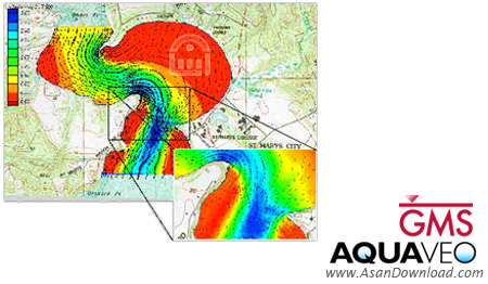
حوزه های آبخیز و سفره های آب زیر زمینی منبع اصلی حیات انسان و منبع محدودی برای مصارف ما از جمله مصارف صنعتی و مصارف کشاورزی می باشند از این رو بررسی، مدیریت و تحت کنترل قرار دادن این منابع با ارزش امری ضروری و انکار ناپذیر می باشد. نرم افزار Aquaveo GMS Premium با توانایی مدل سازی و شبیه سازی تمامی منابع آبی از جمله منابع سطحی و زیر سطحی این امکان را برای کاربر فراهم می کند تا در بررسی های مختلف خود بتواند از داده های خروجی نرم افزار برای آنالیزهای لازم، ارائه ها و مقاصد آموزشی و پژوهشی استفاده نماید. شرکت Aquaveo با بیش از پانزده سال سابقه فعالیت در بررسی حوزه های آبخیز
توانسته با ساخت نرم افزار جامع و کاملی در این زمینه نیاز های کاربران را
برطرف نموده و مسیر توسعه را در این زمینه هموار سازد. این نرم افزار می
تواند پایه و اساس فعالیت بسیاری از کاربران و مشاغل از قبیل مهندسین
آبخیزداری، هیدرولوژیست ها و یا دانشجویانی با رشته های مرتبط قرار گیرد.
همچنین از خروجی های نرم افزار می توان در قالب ارائه های پاورپوینت،
انیمیشن ها و دیگر فرمت های بصری رایج استفاده نمود. هدف اصلی GMS ایجاد
یک درک سه بعدی دقیق و کامل از حوزه های آبخیز و لایه های آبی زیر زمینی می
باشد تا در بررسی های ثانویه، پروژه های بزرگ عمرانی، سد سازی، آب بند
سازی، زهکشی و یا حتی مدیریت بحران بتوان از آن استفاده نمود. این برنامه
توانایی خواندن انواع فایل ها از جمله تصاویر شطرنجی،نقشه های
توپوگرافی، فایل های CAD و غیره را دارد و می توان از آنها در ساخت یک طرح
کامل بهره گرفت.
برخی ویژگی های کلیدی نرم افزار Aquaveo GMS Premium:
- قابلیت مدل سازی انواع حوزه های آبخیز و منابع آبی با هر شکل و اندازه
- قابل استفاده توسط مهندسین آبخیزداری، هیدرولوژیست ها، مهندسین آب، سازمان ها و ...
- قابل استفاده در محیط های ارائه یا انیمیشن ها
- قابلیت افزودن برچسب های مختلف بر روی محصول نهایی از جمله مقیاس، جهات جغرافیایی و...
- امکان وارد نمودن اطلاعات چینه شناسی
- توانایی بکار بردن نقشه های توپوگرافی و ارتفاع سنجی
- ایجاد درک سه بعدی کامل
- رابط کاربری روان و جامع
- سازگار با نسخه های مختلف سیستم عامل محبوب مایکروسافت ویندوز
- و...


Our name is synonymous with visualizing water. Our software
solutions provide tools to engineers for modeling groundwater and
surface-water in the areas of hydrology and hydraulics. Our customers
around the world rely on our solutions to complete today’s demanding
water resources projects.
GMS is the most intuitive and capable software platform used to create groundwater and subsurface simulations in a 3D environment.
“I’ve used GMS for over 15 years on a wide variety of modeling and
visualization projects. The conceptual model approach/tools and
continuing improvements to the software allow me to efficiently develop
cost-effective models for clients who are always concerned about their
budget. The Aquaveo development team is very responsive to
questions/suggestions and the online discussion group is a great forum
for both users and developers...”
Speed up & simplify model building with the conceptual model approach in GMS:
We
pioneered conceptual modeling and have refined it over many years.
That's why GMS is the quickest and most intuitive groundwater modeling
interface available. Construct a high level representation of the model
using familiar GIS objects: points, arcs and polygons and easily update
the model as needed.
3D visualization optimized for performance:
GMS is the most advanced software system available for performing groundwater simulations in a three-dimensional environment.
- Interact with models in true 3D
- Optimized OpenGL graphics for improved hardware rendering
- Create photo-realistic renderings
- Generate animations for PowerPoint or web presentations
- Drape images over the model and control the opacity
- Annotations – Add north arrows, scale bars, reference images, company logos, and more
Import a variety of data formats & imagery:
Models require data from many different sources. That’s why GMS is built to easily import numerous file types:
- Raster images including georeference and projection support
- Topographical maps & elevation data
- Borehole data including stratigraphy and geophysical data
- Native MODFLOW files
- MODFLOW files from Visual MODFLOW, Groundwater Vistas and PM Win
- Web data services such as TerraServer
- ArcGIS geodatabases and shapefiles
- CAD files including .dwg, .dgn, and .dxf formats
- Worldwide projection support including Cartesian and Geographic Systems
- File Import wizard for delimited text files and spreadsheets